

dovedale walk, bunster hill and thorpe cloud
Peak District
Another popular walk in Peak District is Dovedale walk, Bunster Hill and Thorpe Cloud.
Dovedale is owned by National Trust and attracts a million of visitors every year.
Dovedale is a valley in Peak District, cut by River Dale and runs for just over 3 miles between Milldale in the north and a wooded ravine near Thorpe Cloud and Bunster Hill in the South.
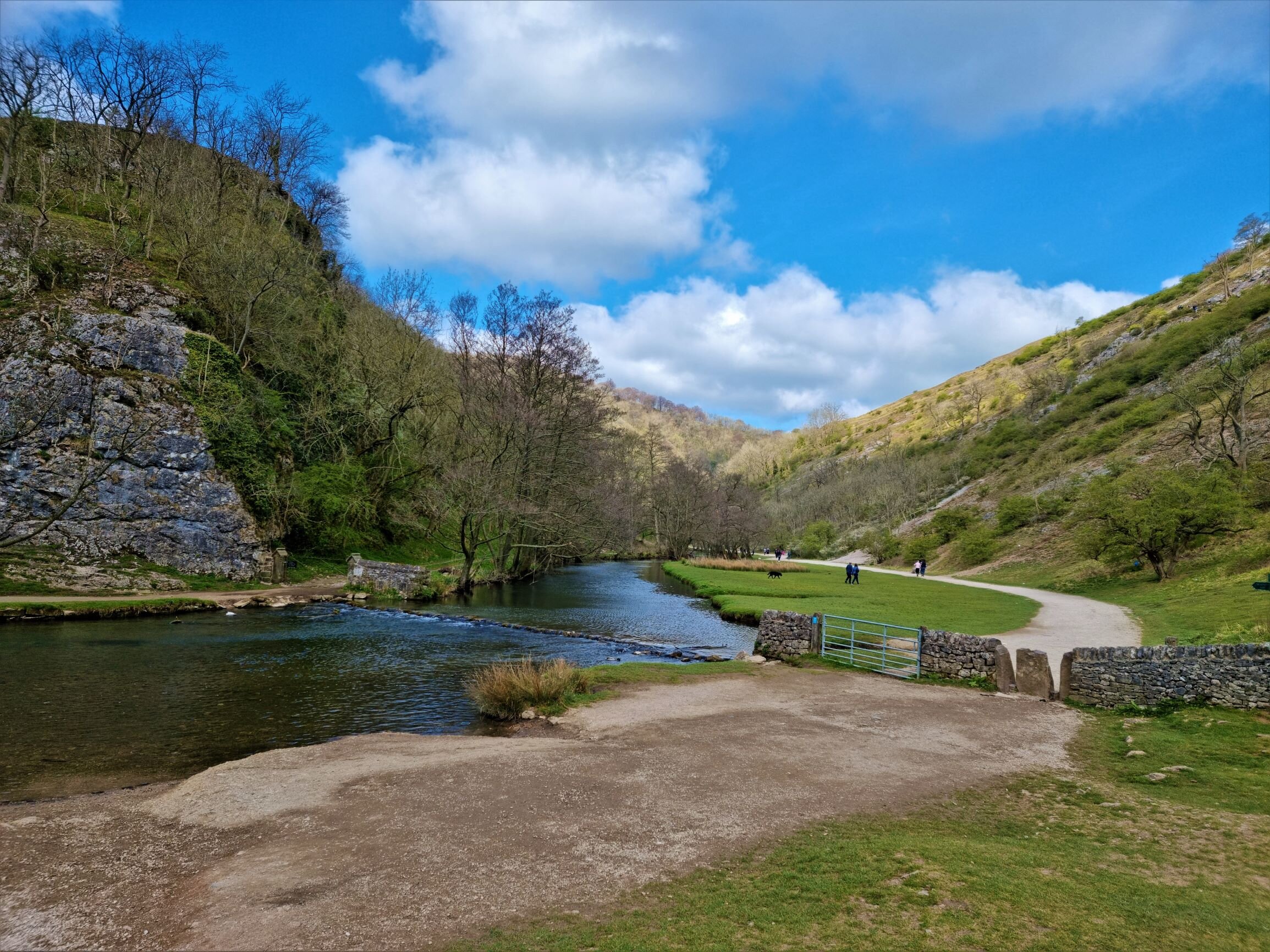
The route starts from Narlow Lane car park, near Thorpe village, free of charge. There are multiple car park closer to the river and Dovedale car park with public toilets and information point.
We left the car park and walked towards Thorpe Cloud. The field towards Thorpe Cloud was filled with signs and you could hear the shooting. The Chesterfield and District Rifle and Pistol Club are organising shooting in that area.

The climb to Thorpe Cloud is steep and rocky but a good warm up exercise. The isolated limestone hill (287m height) is a steep climb to the top, dangerous in some area due to path erosion and paths being closed off for the same reason. The going is strenuous and slightly dangerous in places as the ground is loose and unstable, even if you do have good hiking footwear. However, it is definitely worth it and you will be amazed how beautiful is from up there.
Take a deep breath in and enjoy the scenery, the wind and everything that the nature has to offer.


We have descended and walked to River Dove to see the stepping stones. This area is very popular and I prefer going early in the morning to be able to enjoy the walk.
Walking upstream the river was the most relaxing walk I have done in awhile. The path is very accessible but I would still suggest you take your booths if you want to adventure yourself through the woodland.
Along the river Dove, just few miles away from the Stepping Stones, on the right hand side there is an amazing cave, Reynard’s Cave.
Reynard’s cave was formed end of the last Ice Age, around 10,000 years ago, when glacial meltwater swelled the Dove into a powerful torrent.
It is a short detour from the path and a steep, very rocky climb to the cave but I am glad we found it.


Round the corner from the arch is Reynard’s Kitchen – the home of some of our prehistoric ancestors. A hoard of late Iron Age and pre-Conquest Roman coins, said to be the most significant find of its kind in Britain, was found here in 2014. The cave is thought to have been named either after a local brigand who made it his refuge or for its use by foxes as a den.
There are other caves along this route, on each side of the river Dove. The Dovedale walk is around 10 miles long but this time we wanted to have a short Sunday walk so at Ilam rock we turned left towards Bunster Hill.
Amazingly, the 25m- high leaning finger of Ilam Rock has several rock climbing routes up its precipitous sides, while Pickering Tor has a gaping cave at its foot.
The path from the Ilam rock to the top of Bunster hill is through the woodland, very steep and was filled with wild garlic. The smell of wild garlic made me think of food so once we reach to the top, outside of the woodland near a farm we stopped for our lunch. Perfect spot with a nice view of Thorpe Cloud and the limestones on the other side of the River Dove.

The circular route is around 6.3 miles( 10km) and it’s perfect for a Sunday morning hike. I have really enjoyed the walk and I would like to go back and do the Dovedale 10 mile circular walk but another weekend, another hike.


